 |
| Website Home (Menu del Dia) | ||
| Previous | Alaska Home | Next |
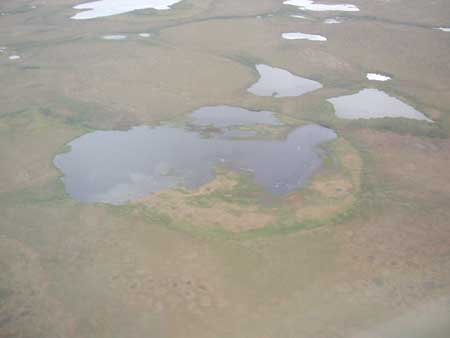
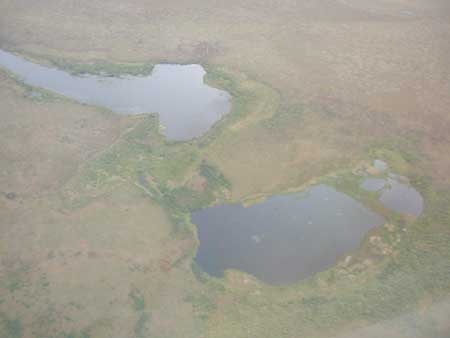
Tundra lakes on the Baldwin Peninsula
|
The widespread distribution of tundra lakes is seen in these aerial photographs of the Baldwin Peninsula taken on final approach to Kotzebue. Lakes such as these are indicative of continuous permafrost just below the ground's surface.
The lakes form during the long days of summer when the sun's heat begins melting the surface of the permafrost in a surface depression or patch of exposed ground. A bowl forms as the ice melts and the marshy ground sinks below the water in to replace the ice. The resulting body of water is trapped by the permafrost. Sometimes, with each passing summer, the water becomes a reservoir for the sun's heat and melts more permafrost, steadily enlarging the lake. Strong winds stretch lakes into ovals and can even move them across the landscape.
The strict definition of permafrost is ground frozen for two or more consecutive years, but most of it formed during the last Ice Age and has been frozen for 15,000 years or more. When permafrost comes within six feet of the surface, the shallow layer of soil that melts every summer can't support root systems to anchor anything larger than bushes and tree scrub. In Alaska's northern latitudes, the permafrost can be up to 2,000 feet deep and extends several miles into the seafloor of the Arctic Ocean and Beaufort Sea.
 |
| Website Home (Menu del Dia) | ||
| Previous | Alaska Home | Next |